
The Blue Line of the Vosges Mountains
Patrick Vidal

Vosges and the mountain range
Image | Patrick Vidal
The heat wave was coming. So I thought it was time to go on vacation in the Vosges Mountains.
A range of low mountains culminating in the Ballon d’Alsace at 4,663 feet, the Vosges are covered with forest and usually never very hot. At least that’s what Mr. Weather Forecast told us!
Was he wrong or what? We got hit by exactly the same heatwave that touched the western part of France. Temperatures around the 100 degrees fahrenheit. Not a common thing in the north of France.

The mountainous regions of France
Image | Grand Album La France
In continental France there are five mountain ranges: The Alps, the Pyrenees border with Italy and Spain; as its name implies, the Massif Central is located in the center of France; the Jura borders Switzerland; and then the Vosges, northeast of France, borders nothing.
Well, that’s not entirely true. Historically, the Vosges were—for a very long time—the dividing line between France and the Germanic countries. It was only in 1648, when Louis XIV conquered Alsace, that they lost their border role.
By the way, on the map, ignore the Massif Armoricain. Its highest point is only 1,300 feet—a mere molehill and not so much a mountain range.
Geographically, the Vosges are made of three very distinctive regions:
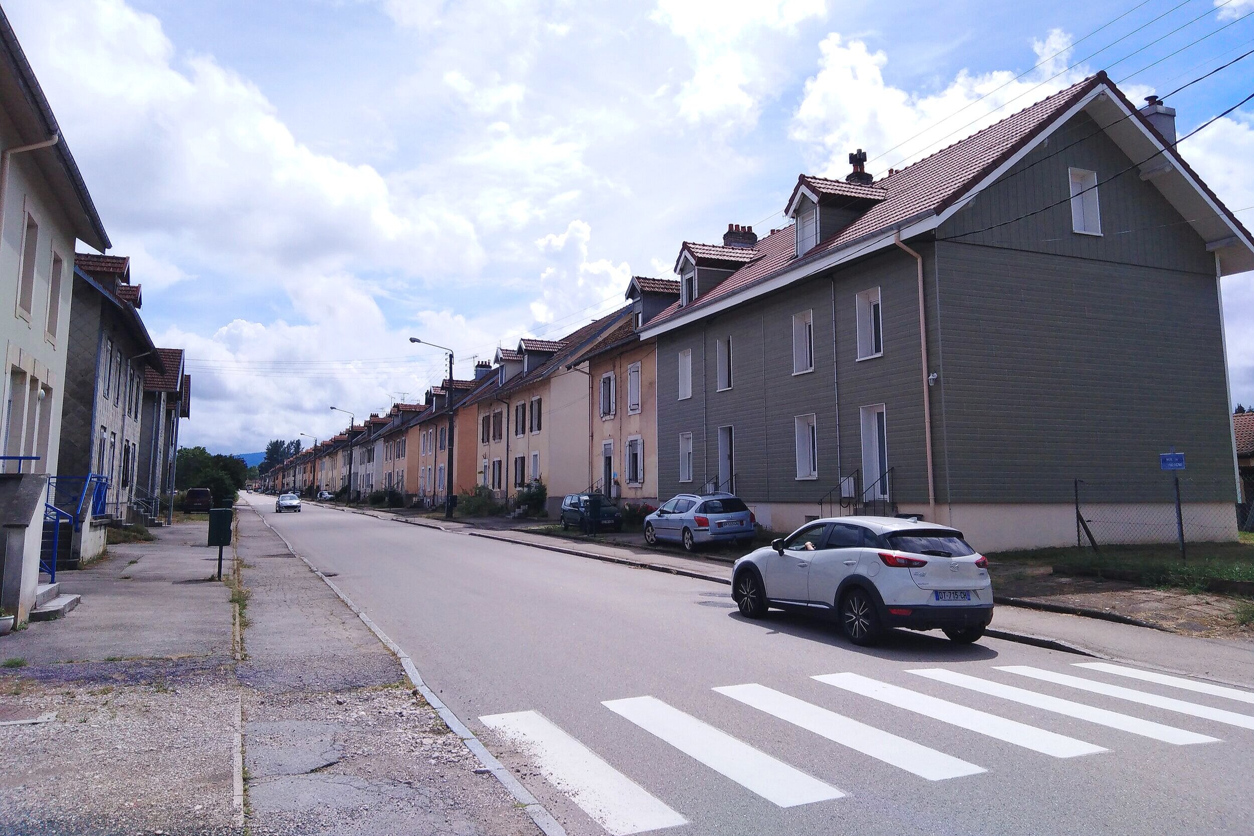
The western part, touching the Lorraine, is very agricultural, remote, and pretty poor. Historically, it was home to an important textile industry. In 1860, it had 110 factories and 15,000 workers which grew to 242 factories for 40,000 workers by 1930. Globalization in the second half of the twentieth century put an end to that. Today, only a few factories remain, but you can still see the line of what used to be worker houses from the entrance of the village.
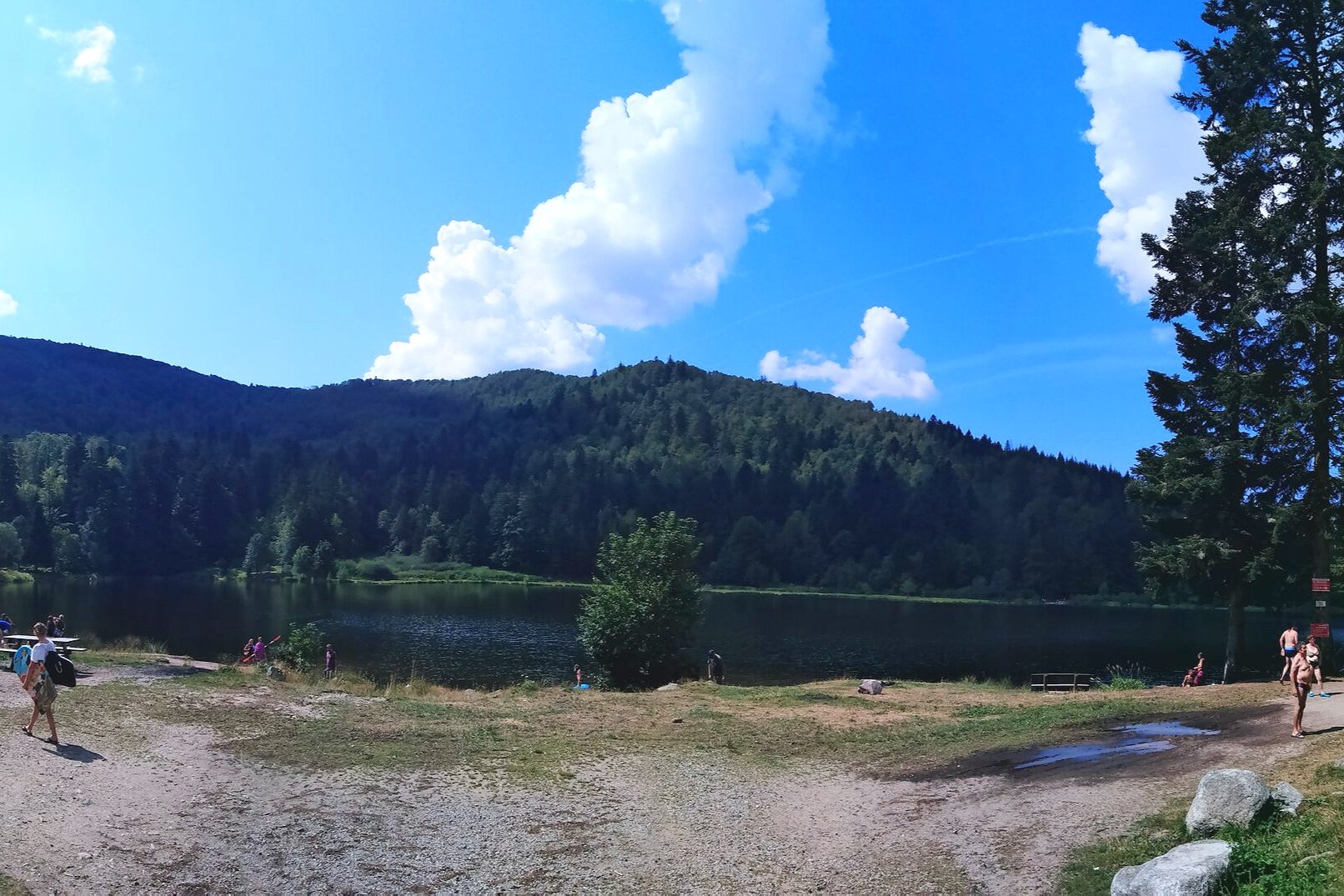
The central part of the Vosges is higher and more remote, but a perfect place for tourism and outdoor activities. It has very nice lakes and some ski resorts that are in big trouble these days because of their lack of altitude and, consequently, snow.
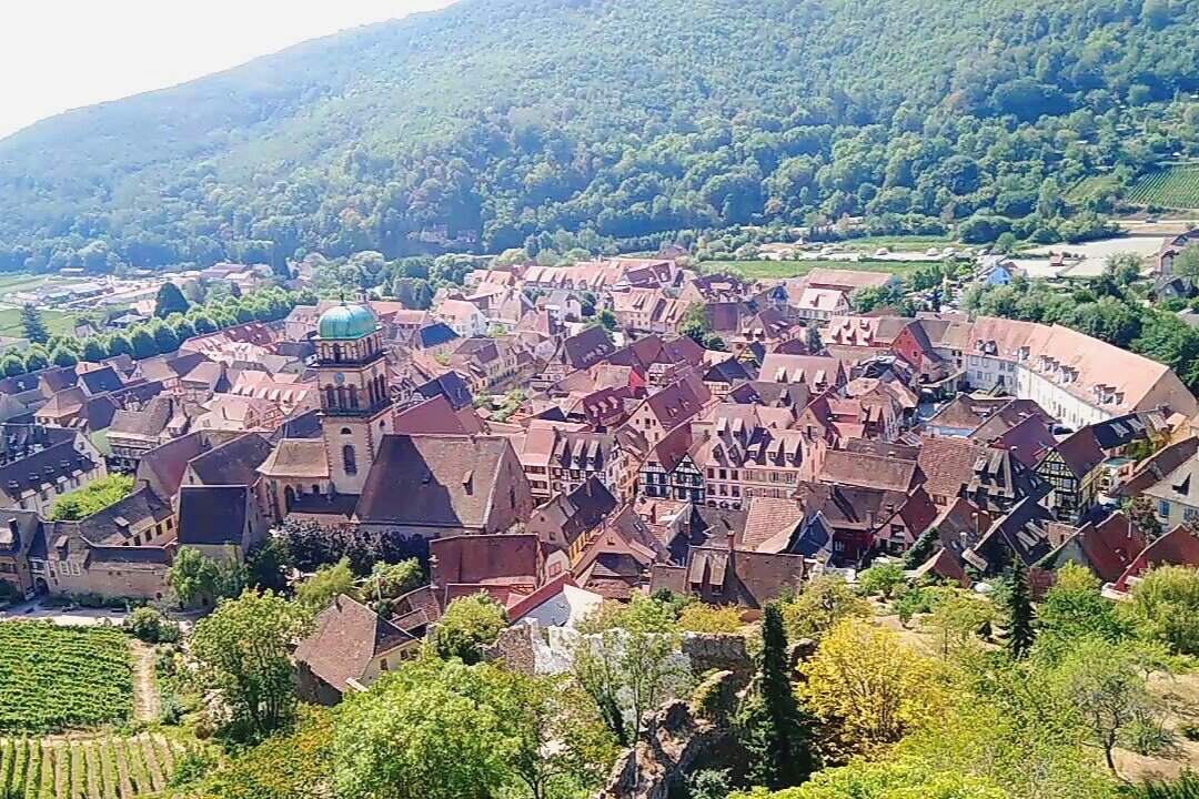
The eastern part borders the Alsace region, and its economy is based on winemaking. It’s a thriving place, and the cuteness of its villages makes it a favorite spot for tourists from all over the world.
As a walker, one of the most distinctive things I always notice in the Vosges is the way they mark their paths. Since the end of the nineteenth century, the local hikers’ club—Club Vosgien— has used and developed its own way of marking the trails. It’s precise and organized but, as you can see in the picture, it can also be a little bit confusing for somebody not very familiar with this system.

Vosges trail markings
Image | Patrick Vidal
On one of my hikes around the little town of Bruyeres (heather in French), I saw this trail marker for a U.S. monument, so I changed course a little bit. I discovered the monument in the middle of nowhere (obviously not often visited) and the placard explains why Bruyères is a twin town with Honolulu:
“To the men of the 442nd who reaffirmed an historic truth here…that loyalty to one’s country is not modified by racial origin. These Americans, whose ancestors were Japanese, on Oct.30.1944 during the battle of Bruyeres broke the backbone of the German defenses and rescued the 141st infantry battalion which had been surrounded by the enemy for four days.” —Presented by the Japanese American citizens league
Quite moving to say the least.

U.S. Monument to the Liberation of Bruyères.
Image | Patrick Vidal
The title of this article, “The Blue Line of the Vosges Mountains” (translated from “La ligne bleue des Vosges”), comes from the fact that after the Franco- Prussian War (the War of 1870), Germany annexed what we always refer to as Alsace Lorraine but was more precisely Alsace and Moselle (just a part of Lorraine), and the Vosges regained their status as a border between France and Germany. So this line became the symbol of the French revenge and animosity against the Germans and remained that way until the First World War.